Climate & Environment
Heat Dome to Bring Scorching Temperatures to Southern Europe as UK Faces Changeable Weather
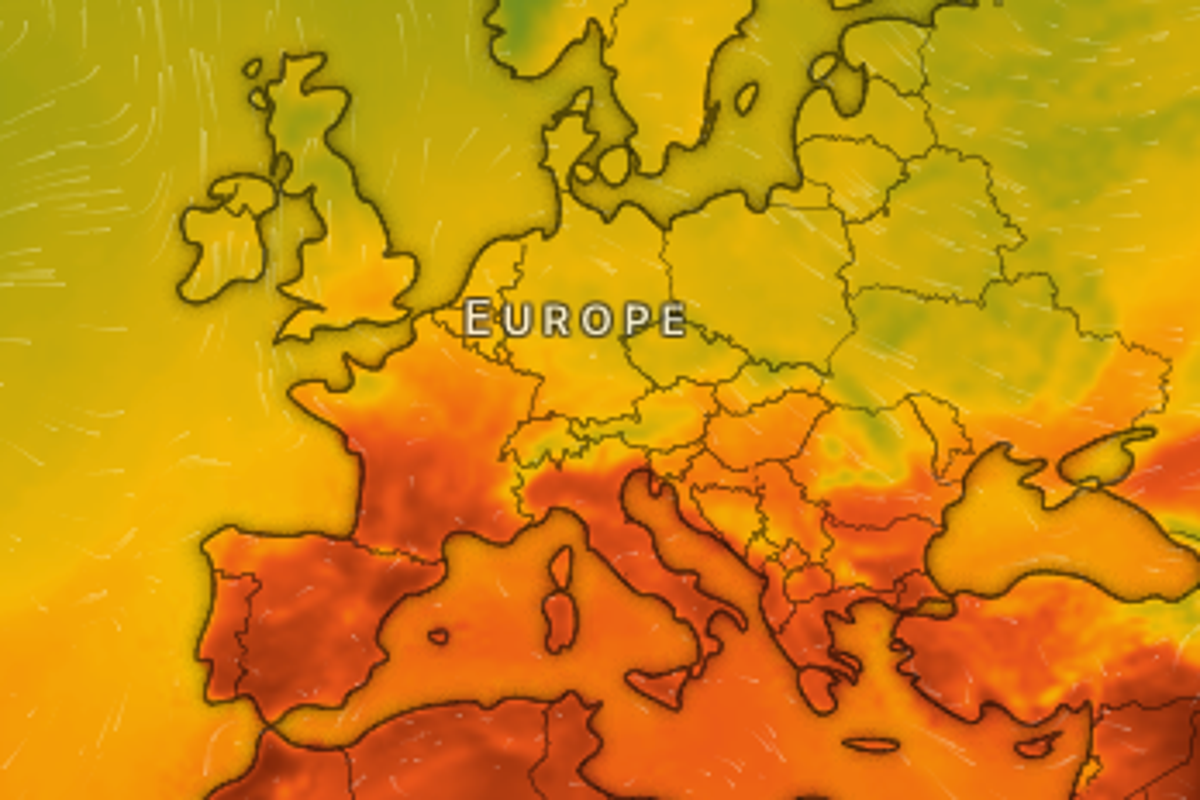
Meteorologists are forecasting a powerful heatwave across parts of Europe as a heat dome forms, pushing temperatures to extreme levels in the region. According to BBC forecasters, parts of southern Europe and the Mediterranean could see temperatures reach the high 30s and even 40 degrees Celsius in early September.
The surge in heat is being driven by warm air moving from North Africa into France, Spain and Italy, combined with a high-pressure system that is forming a heat dome over the region.
The Met Office explains that a heat dome occurs when a large area of high pressure settles over a region for a prolonged period. Under these conditions, air sinks through the atmosphere, becoming compressed and warmer as it descends. This process also suppresses cloud formation, allowing intense sunshine to reach the ground unobstructed.
The heat dome currently developing over Europe is expected to bring a hot start to September across France, Spain, Italy and the Balkans. Over the coming week, temperatures in low-lying valleys and coastal areas of Spain and Italy could range between 38C and 42C. Forecasters anticipate that this heatwave will persist for an extended period in southern Europe.
Both the Spanish and French weather services have issued warnings about heightened wildfire risks, noting that the landscape remains dry following the hot summer conditions.
In contrast, the UK is not expected to experience a comparable heatwave. Warmer and sunnier conditions were forecast for the weekend, with London expected to reach highs of 26C on Sunday. However, this warm spell is set to be short-lived, with temperatures cooling early in the week. Similarly, temperatures across Europe are expected to decline from Tuesday onward.
The UK will instead see more changeable weather, with a mix of rain, showers and some sunshine. The Met Office’s long-range forecast for the period between 11 and 20 September describes conditions as “changeable initially, with some dry interludes and relatively cool nights, interspersed with occasional spells of rain and showers arriving from the west,” and notes the possibility of strong winds at times.
The forecast adds that there may be a trend toward longer dry spells between weather systems as mid-September approaches, but cautions that a return to settled, dry weather is unlikely at this stage. Temperatures are expected to remain close to average, with some cool nights still possible.
According to the Met Office’s five-day UK forecast, Monday will bring largely dry and bright conditions to southern and central areas, while the north will turn more unsettled with blustery rain and gales. The south will feel warm in sunny spells, while the north will be fresher. Overnight, a band of rain will move south across England and Wales, becoming heavy at times, while blustery showers and strong winds continue in the north.
On Tuesday, heavy rain is expected to clear the southeast during the morning, giving way to a brighter day for many, with a fresh feel. Winds will gradually ease in the north, though showers will continue there.
Looking ahead, Wednesday is expected to be drier and brighter with spells of sunshine. Another band of rain is forecast to move in on Thursday, before drier and brighter conditions return on Friday. Temperatures throughout this period are expected to remain close to average.