Climate & Environment
Southern Ontario Braces for Another Round of Severe Storms Amid Late-Summer Heat
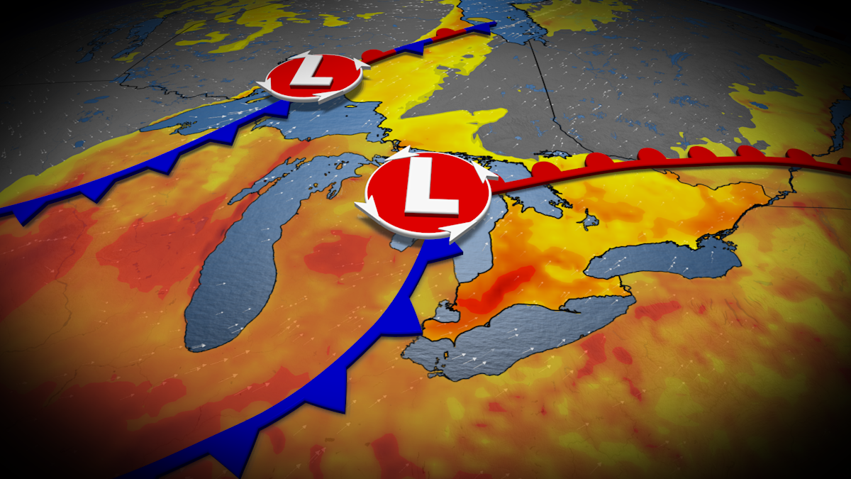
Southern Ontario is facing another potentially stormy Wednesday as heat, humidity, and an approaching frontal system combine to create a risk of severe thunderstorms. Forecasters warn the storms could bring heavy rain, localized flooding, and strong wind gusts of up to 80 km/h.
The warning comes just a week after severe storms caused flooding, damaging winds, and tornadoes across parts of Ontario, including an incident in Vaughan where a road collapsed into a river.
An upper trough moving across the Great Lakes region on Wednesday is expected to elevate the risk of thunderstorms across a swath of southern Ontario, with heavy rain, gusty winds, and localized flooding identified as the primary hazards. Residents are being urged to stay alert to changing conditions and to check for weather warnings in their area.
According to meteorologists, a Prairie low is lifting across northwestern Ontario toward Hudson Bay, allowing a more humid southerly airflow to develop across the province. Temperatures are expected to climb into the mid-20s by Tuesday and Wednesday, with Windsor and Sarnia potentially reaching 30 degrees.
Moisture levels and atmospheric energy needed to fuel thunderstorms are expected to peak across southern Ontario on Wednesday, ahead of an approaching cold front. Heavy showers and thunderstorms are forecast to begin early Wednesday in cottage country and Muskoka, with the potential for storms increasing throughout the day in areas farther south.
Weather models suggest a relatively narrow band of heavy precipitation, though forecasters say confidence in the exact location remains low. The cold front is expected to move across southern Ontario Wednesday evening and overnight, bringing an end to the thunderstorm threat and reducing humidity levels.
Localized flooding remains a key concern, with total atmospheric moisture expected to range between 40 and 60 millimetres — a level considered a warning sign for flooding potential. Forecasters noted uncertainty about how much atmospheric instability will develop across the region on Wednesday, which will influence the strength of any thunderstorms. Exact rainfall totals remain difficult to predict given this uncertainty.
Gusty winds within stronger, more organized storms could reach or exceed 80 km/h. Officials are advising residents in affected areas to monitor weather alerts and prepare for possible disruptions.
Looking beyond Wednesday, meteorologists expect changeable temperatures and an unsettled weather pattern to continue through mid- and late September, as the region remains caught between warm conditions to the south and cooler air pushing down at times. Despite this variability, temperatures are expected to trend slightly above normal overall, with drier conditions anticipated by late September.