Climate & Environment
Warm Spell Brings 28C Highs Before UK Weather Turns Cooler and Wetter
By Dan Haygarth
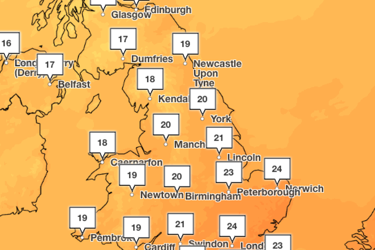
The UK is set to shift back to milder, more typical autumn conditions this week following a weekend of unusually warm, summer-like weather that pushed temperatures into the mid-20s in some areas. A southerly wind carrying hot, humid air from mainland Europe drove temperatures above seasonal norms on Sunday, bringing sunshine and clear skies to much of the country. Warm conditions are expected to persist into Monday, with parts of the south east reaching around 24C. However, temperatures are forecast to drop closer to seasonal averages from Tuesday, as more unsettled weather moves in. From Tuesday, highs are expected to reach about 20C in London and other parts of southern England, while temperatures in Manchester and northern England could fall to around 16C. The warm spell follows confirmation from the Met Office this week that the UK has provisionally recorded its hottest summer since national records began nearly 150 years ago. Five separate heatwaves between May and August left much of the country in drought conditions and contributed to wildfires and disruption to travel. According to the Met Office, the average mean temperature across June, July and August reached 16.5C, surpassing the previous record of 16.1C set last year. The agency had earlier indicated the UK was on track for a record-breaking summer, provided temperatures remained close to average through the rest of August, and final figures are expected to confirm the new record. The summer's peak temperature was recorded on 13 August at Kew Gardens, where the mercury reached 38.1C. Although this fell short of the UK's all-time record of 40.3C, set in Lincolnshire in July 2022, several other milestones were reached, including three separate days this year on which temperatures exceeded 37C. Before this year, such temperatures had only been recorded nine times in UK history, meaning a third of all instances occurred within this single summer. Looking ahead, the Met Office forecasts a mixed and changeable week. Monday is expected to bring dry, bright conditions across southern and central England, though northern areas may see strong winds and blustery rain. Overnight, a band of rain will move south across England and Wales, potentially becoming heavy at times, while northern regions continue to experience showers and strong winds. On Tuesday, rain is expected to clear from the south east during the morning, giving way to brighter, cooler conditions for much of the country, with winds easing in the north despite continued showers. Wednesday is forecast to be drier with sunny spells, followed by further rain on Thursday, before conditions become drier and brighter again on Friday, with temperatures expected to hover near seasonal averages.