Climate & Environment
Kauai and Niihau Brace for Flooding as Hurricane Lowell Skirts Hawaii
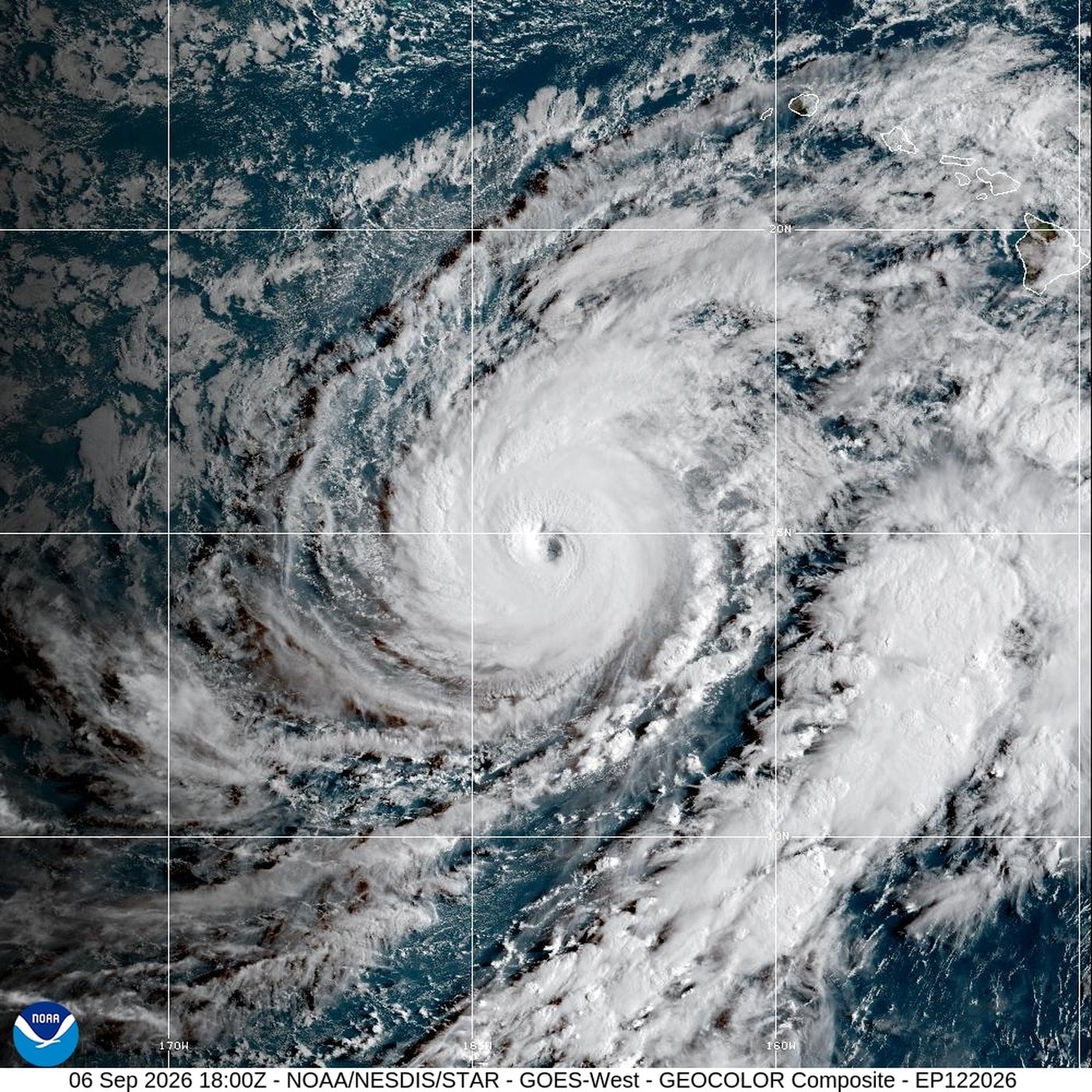
Officials in Hawaii have urged residents and visitors to prepare for heavy rain, flooding and potential mudslides as Hurricane Lowell, a major Category 3 storm, prompted the National Hurricane Center to issue a tropical storm warning for the islands of Kauai and Niihau on Sunday.
The Miami-based center said Lowell was expected to pass west of the islands late Monday and into Tuesday as it moved northward. Forecasters predicted rainfall totals of 6 to 10 inches (15 to 25 centimeters) for the warned areas, with isolated maximum totals reaching 14 inches (36 centimeters). Hawaii's Big Island was forecast to receive 4 to 8 inches (10 to 20 centimeters) of rain, with some locations potentially seeing up to 12 inches (30 centimeters).
At the time of the advisory, Lowell had maximum sustained winds of 125 mph (205 kph) and was positioned about 575 miles (925 kilometers) south-southwest of Lihue, roughly 595 miles (955 kilometers) south-southwest of Honolulu. The storm was moving north-northwest at 5 mph (7 kph). Hurricane-force winds extended up to 50 miles (85 kilometers) from its center, while tropical storm-force winds reached out as far as 175 miles (280 kilometers), according to the hurricane center.
Officials warned that the heavy rainfall could trigger significant flash flooding and mudslides. Combined with tidal effects, storm surge could push water levels along Kauai's coast up to 3 feet (1 meter) above normal, flooding areas that are typically dry.
The Kauai Emergency Management Agency advised residents to fill their gas tanks, charge electronic devices, refill prescriptions, and stock up on food and water, warning that people should be ready to remain at home for several days.
In Lihue, a town of about 8,000 residents that is home to Kauai's main airport, supermarket shelves were emptying as people stocked up on supplies. Real estate agent Lori Benkert purchased an extra 10-pound (4.5-kilogram) propane container so she could cook on a barbecue if the power went out. Benkert, who manages dozens of properties on Kauai, said she had boarded up two houses on the island's western side.
"We'll lose some power, probably have some trees, a bunch of tree limbs coming down," Benkert said. "Everybody is probably going just to hunker down."
Separately, Hurricane Marie was generating dangerous surf conditions off Southern California. The Category 1 storm was located about 800 miles (1,290 kilometers) west of the southern tip of Mexico's Baja California peninsula, with maximum sustained winds of 80 mph (130 kph). Forecasters said Marie was moving northwest at 9 mph (15 kph), tracking roughly parallel to the U.S. West Coast over the following days.
While no coastal watches or warnings were issued for Marie, the hurricane center said swells from the storm would continue affecting southwestern Mexico, the Baja California peninsula and Southern California in the coming days, raising the risk of life-threatening surf and rip currents.
Associated Press writers Wufei Yu in Phoenix and David Fischer in Miami contributed to this report.