Technology
New Radar Site Chosen to Improve Weather Forecasting for South Island
By RNZ | Te Reo Irirangi o Aotearoa
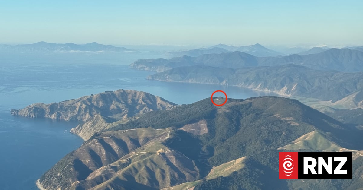
The Government has selected a site for a new radar on the South Island’s northern highlands to fill a gap in weather‑forecasting coverage. The project, fast‑tracked after severe storms and flooding last July, will receive up to $5 million in funding. South Island Minister James Meager said the Nelson Tasman region has limited radar coverage because it largely relies on the Wellington radar, which cannot adequately monitor parts of northwest Tasman. He noted the area has experienced several high‑impact flooding events, including five states of emergency since 2011, and that the new radar will help communities prepare for future disasters.
The radar will be installed near Horoirangi Peak, about 15 km northeast of Nelson City, at an elevation of 630 m. It is expected to be operational by mid‑2027. MetService will install and operate the radar, with annual operating costs estimated at around $260,000. The system will use modern Doppler dual‑polarisation technology to provide more accurate rainfall estimates and enhanced weather monitoring.
MetService general manager of observing systems Kevin Alder said the Prime Minister’s announcement last July that the Government would fund a radar for the region came as “a bit of a surprise,” and that a lot of work had followed to make it happen. Alder explained that MetService evaluated about ten sites on the eastern hills around Nelson, the central hills around Moutere, and the area toward Motueka and Kahurangi National Park. Horoirangi was chosen because it offered the right altitude and landowners were willing to host the infrastructure. He noted the key challenge was finding a location that was not too high, where the radar would miss weather, or too low, where it would be blocked by mountains.
The radar will provide real‑time information on precipitation, wind fields, thunderstorms and hail. Alder said the Wellington radar’s coverage lacks the detail required, and the new system will increase confidence in decision‑making for the region. He added that the radar will give hydrologists, Civil Defence and the community data they can trust.
Andrew Stephens of Ngāti Tama ki Te Waipounamu said the Horoirangi maunga and surrounding area are very dear to iwi. He recalled his great‑grandmother Hūria Mātenga and others who helped rescue people from the American‑built brigantine Delaware when it wrecked off the coast of nearby Whakapuaka in 1863. Stephens said the knowledge gathered from the new radar will be available from the mountain and will save lives, help industry and the community.
Tasman Mayor Tim King said the project moved quickly after the Government announced funding following last year’s floods. He said the radar will be a valuable tool for flood preparation and will provide resilience because it is separate from the weather event itself. King added that while more data will be available, people on the ground are still needed to interpret it and advise incident controllers and decision makers.
Nelson Mayor Nick Smith said it is a relief that the radar will soon be operational, as the region has faced many emergency events in the past decade. He noted that the lack of adequate information has made it difficult to decide whether to evacuate or declare a state of emergency. Smith said the new equipment will help manage risks, save lives and make the community more resilient.
Retired Tasman District Council hydrologist Martin Doyle said he has campaigned for a weather radar in the region since 2010, after a massive flood in the Aorere River left hydrology staff without knowledge of rainfall origins. Doyle said the radar will allow hydrologists and community members to see where rain falls in confined areas, enabling better analysis and decision‑making. The information will help Civil Defence and Emergency Management make better decisions and allow the community to keep themselves safe.